

— Blogs —
—Products—
 Consumer hotline +8618073152920
 WhatsApp:+8615367865107
Address:Room 102, District D, Houhu Industrial Park, Yuelu District, Changsha City, Hunan Province, China
Product knowledge
Time:2024-11-14 11:42:17 Popularity:2597
Hydrologic analysis is a method of analyzing, calculating and predicting water resources and hydrologic processes, which is an important part of hydrology and is significant for the rational use and protection of water resources. The following is a detailed explanation of hydrological analysis:
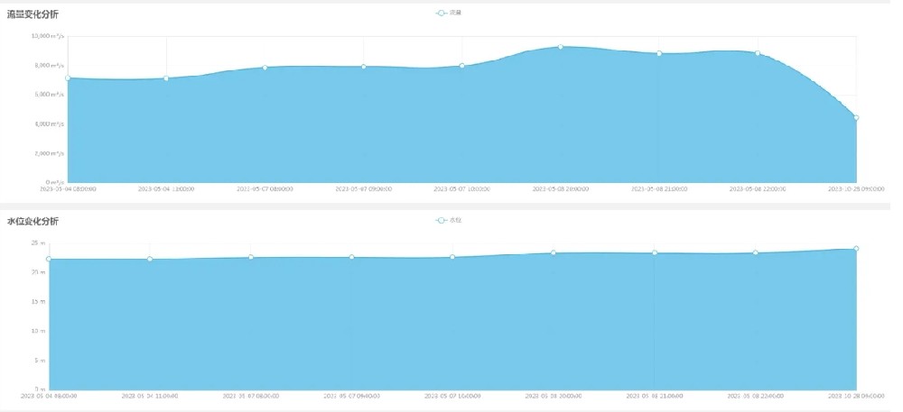
Hydrological analysis is the use of mathematical and statistical methods to analyze hydrological data (such as rainfall, flow, etc.), to explore the regularity of the hydrological process and the trend of change, in order to carry out the rational use and management of water resources.
1. to explore and study hydrological phenomena:
- Reveal the physical mechanisms and laws of hydrological processes, including the experimental study of various hydrological cycle elements such as precipitation, evaporation, runoff, soil water, groundwater, water quality, sediment, etc., as well as their changing patterns under the influence of different natural regions and human activities.
2. Provide basis for water resources management:
- Through the analysis of hydrological data, the quantity, quality and distribution of water resources can be understood, and decision-making support can be provided for the rational allocation and effective utilization of water resources.
3. environmental protection and prevention:
- To find out the change rules of groundwater quantity and quality, and to provide an important basis for the protection of groundwater resources. At the same time, reveal the impact of human activities on water quality and ecological environment, provide scientific guidance for environmental protection and ecological governance.
4. Solve the problems of hydrological science:
- It is an important means to elucidate and solve some basic theoretical problems and important production topics in hydrological science and hydrological operations. For example, to study the transformation relationship between precipitation, surface water and groundwater, and the impact of human activities on the water quantity and quality of the basin.
5. Improvement of hydrological sciences:
- Promote the development of hydrological science, through in-depth study and analysis of hydrological phenomena and processes, constantly improve the hydrological theory and method system, and improve the level of hydrological science and technical ability.
1. statistical analysis:
- Using historical hydrological data, reveal the regularity and change trend of hydrological processes through mathematical and statistical methods.
2. model analysis:
- Through the establishment of mathematical models, simulation and prediction of changes in hydrological processes. Commonly used models include:
- SCS curve number method
- Unit line method
- Hydrologic Response Unit Model (HRUM)
- SWMM (Storm Water Management Model)
- HSPF (Hydrologic Simulation Program - Fortran)
- MIKE SHE (Integrated Hydrological Modelling System)
3. Experimental analysis:
- Direct observation and study of hydrologic phenomena by experimental means.
1. rainfall analysis:
- To study the time distribution, spatial distribution and intensity of rainfall, and to assess the impact of rainfall on hydrological processes. 2.
2. surface runoff analysis:
- Analyze how precipitation is converted into surface runoff, including flood flow, base flow, flood frequency, etc.
3. groundwater analysis:
- Examine the processes of groundwater recharge, flow, and discharge, and assess groundwater storage and dynamics.
4. hydrological cycle analysis:
- Comprehensively analyze the interactions of precipitation, evaporation, runoff, and groundwater to understand the overall pattern of the hydrologic cycle.
5. water quality analysis:
- Monitor and analyze water quality indicators in water bodies to assess water quality conditions and pollution sources.
6. sediment analysis:
- To study the sediment transport and deposition process in rivers, and assess the impact of sediment on hydrological processes and ecological environment.
- Provide scientific basis for rational allocation and effective utilization of water resources. By understanding the quantity, quality and distribution of water resources, we can formulate reasonable water resources management policies to ensure the sustainable use of water resources.
- Forecast floods, droughts and other water disasters, and provide scientific basis for disaster prevention and response. By analyzing the characteristics and regularity of rainfall and runoff, determine the design standard of floods and formulate reasonable flood prevention measures.
- Reveal the impact of human activities on water quality and ecological environment, monitor and analyze water quality data, discover water pollution problems in time and take corresponding management measures to protect ecological environment and human health.
- Through hydrological analysis, solve the basic theoretical problems and important production issues in hydrological science and hydrological business, and promote the development of hydrological science.
- Continuously improve the system of hydrological theories and methods, raise the level of hydrological science and technical capacity, and provide stronger technical support for water resources management and environmental protection.
Measuring water availability effectively and equitably involves multiple considerations and the use of modern technology. The following are key steps and approaches:
- Using data from satellite remote sensing and ground-based observatories, as demonstrated in the study by Y. Zhang et al. by analyzing global changes in terrestrial water resources over the past 20 years can provide a comprehensive view of the state of water resources.
- Isotope techniques are used to fill in the gaps in hydrologic information and help to provide a more comprehensive understanding of water resource dynamics at the national level.
- These models can assess the allocation of water resources across seasons and years, providing a scientific basis for water management and ensuring that resources are allocated appropriately.
- Multi-objective optimization models are constructed to consider social, economic and ecological benefits to ensure fairness and sustainability in the allocation of water resources. For example, the case of the middle and lower reaches of the Han River demonstrates how a multi-objective optimization model can be used to achieve a fair allocation of water resources.
- Following the UN Sustainable Development Goal (SDG) 6, monitoring the entire water cycle to ensure that water resources management not only focuses on drinking water and sanitation, but also covers the sustainability of the entire water system.
- Utilize big data to analyze collected data to improve the effectiveness of early warning systems and provide real-time information for flood forecasting and water resource management.
- Ensure equitable access to water resources for all legitimate water users, including smallholder farmers, women, indigenous peoples and local communities, and promote the equitable distribution of water resources through responsible water rights governance.
Steps:
- Collect various data related to hydrological analysis, including meteorological data (e.g., rainfall, temperature, humidity, wind speed), hydrological data (e.g., river flow, water level, groundwater level), and geographic information data (e.g., topography, land use, soil type).
- The collected data are checked, cleaned and pre-processed to ensure accuracy and consistency. This may include filling in missing data, removing outliers, converting data formats, etc.
- Determine the watershed boundaries of the study area, which is the basis for hydrologic analysis. Watershed delineation and sub-watershed extraction can be performed using Geographic Information System (GIS) tools.
- Analyze how precipitation is converted to surface runoff. This typically involves the use of hydrologic models such as the SCS curve number method, the unit line method, and hydrologic response unit models.
- Time series analysis of river flow data to understand the pattern of flow changes, including peak flow, base flow, flood frequency, etc.
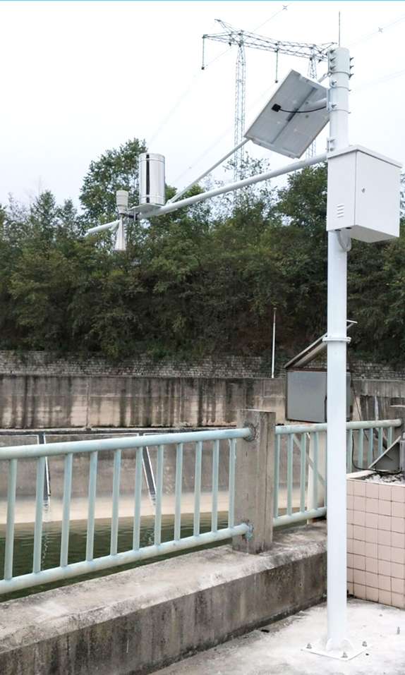
- Frequency analysis: use statistical methods to determine the magnitude of floods at different return periods.
- Flood simulation: use hydrologic models to simulate flood processes under different rainfall scenarios.
- Assessment of the frequency, severity and impacts of droughts, which may involve the calculation of drought indices and the simulation of drought scenarios.
- Assessment of the quantity, quality and availability of water resources within a basin or region.
- Develop hydrologic models to simulate hydrologic processes and perform model validation and calibration with historical data.
- Interpretation of the results of the analysis and recommendations for water resources management, flood control and environmental protection.
- Prepare hydrological analysis reports summarizing the analysis process, results and recommendations.
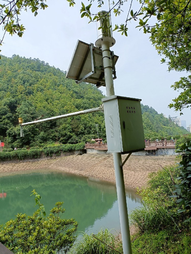
- Used for watershed delineation, terrain analysis and spatial data management.
- Such as SWMM, HSPF, MIKE SHE, etc., for simulating and predicting hydrological processes.
- Such as SPSS, SAS, etc., for data processing and statistical analysis.
- Such as Python, MATLAB, etc. for data processing and model development.
Conclusion
Hydrological analysis is an important scientific method and technical means, which is of great significance for the rational use and protection of water resources. Through systematic hydrological analysis, the regularity and change trend of hydrological processes can be revealed, providing scientific basis for water resources management, flood prevention and control and environmental protection. In the future, with the continuous progress of science and technology and the increasing demand of human society for water resources, hydrological analysis will play a more important role in water resources management, flood prevention and control and environmental protection.
Related recommendations
Sensors & Weather Stations Catalog
Agriculture Sensors and Weather Stations Catalog-NiuBoL.pdf
Weather Stations Catalog-NiuBoL.pdf
Related products
 Combined air temperature and relative humidity sensor
 Soil Moisture Temperature sensor for irrigation
 Soil pH sensor RS485 soil Testing instrument soil ph meter for agriculture
 Wind Speed sensor Output Modbus/RS485/Analog/0-5V/4-20mA
 Tipping bucket rain gauge for weather monitoring auto rainfall sensor RS485/Outdoor/stainless steel
 Pyranometer Solar Radiation Sensor 4-20mA/RS485
Screenshot, WhatsApp to identify the QR code
WhatsApp number:+8615367865107
(Click on WhatsApp to copy and add friends)
