

— Blogs —
—Products—
 Consumer hotline +8618073152920
 WhatsApp:+8615367865107
Address:Room 102, District D, Houhu Industrial Park, Yuelu District, Changsha City, Hunan Province, China
Product knowledge
Time:2024-11-14 11:13:41 Popularity:263
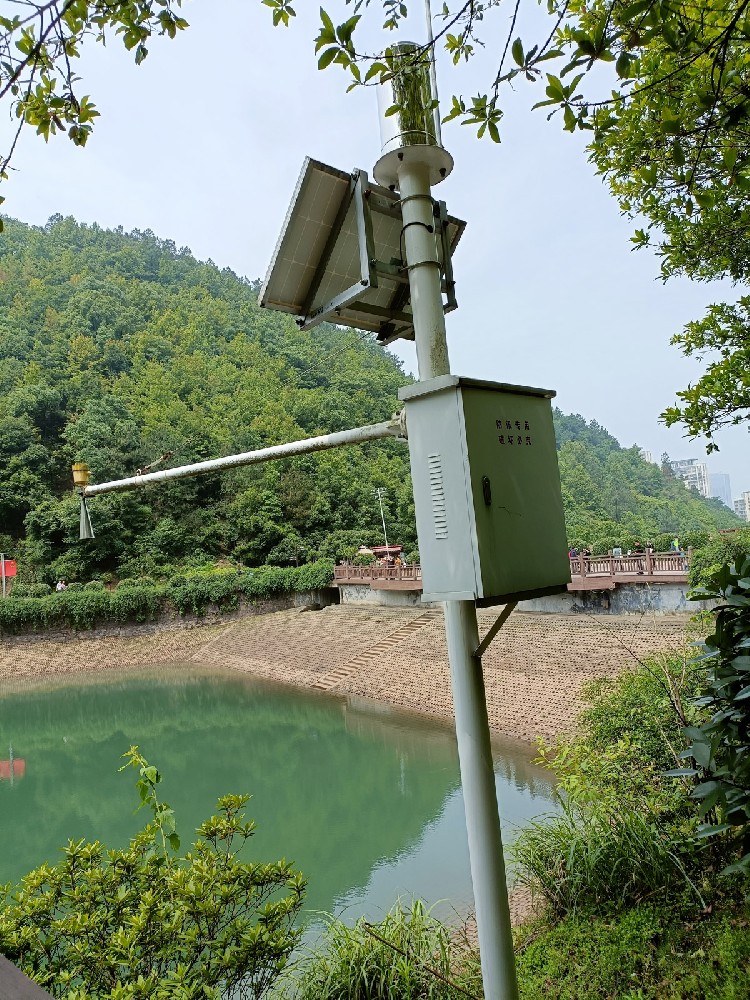
Hydrological monitoring is a continuous or intermittent process of testing the water source, water quantity (including flow, water level, flood tide), water quality (including organic, inorganic and radioactive substances and other pollutants of the comprehensive indicators) and the ecological environment of the waters from the perspective of hydrology of lakes, rivers, wetlands, or terrestrial bodies of water.
1. understand the hydrological cycle: study the movement and distribution patterns of water on earth, including evaporation, precipitation, runoff, groundwater flow and other processes.
2. water resources management: to assess the quantity, quality and availability of water resources, and to provide a basis for the rational development, utilization and protection of water resources.
3. Disaster early warning: monitor signs of natural disasters such as floods and droughts, and issue timely warnings to reduce disaster losses.
4. environmental monitoring: assess the impact of hydrological conditions on the ecosystem, monitor changes in water quality and protect the water environment.
5. Engineering design: provide basic data for the design of water conservancy projects, such as reservoir design, river training, urban drainage system design.
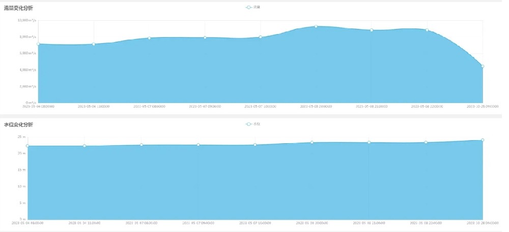
The main contents of hydrological monitoring include but are not limited to:
1. water level: real-time measurement and recording of water level changes in water bodies using water level meters and other equipment.
2. flow rate: measure the flow rate of the water body through flow meters, hydraulic building method, unit power conversion flow measurement method and other ways.
3. flow rate: measure the flow rate of the water body by using equipment such as flow meter.
4. water quality: monitoring the content and changes of pollutants such as organic, inorganic and radioactive substances in water bodies.
5. rainfall (snow), evaporation, sediment, ice and other hydrological parameters.
- By installing video or image acquisition cameras in the river for image capture, superimposed on real-time flow data monitoring.
- Flow meter method: the use of electromagnetic, ultrasonic, laser ranging flow meter and other equipment to measure the flow.
- Water meter method: through the water meter readings to calculate the flow.
- Hydraulic building method: the use of existing hydraulic drainage buildings, through the measured hydraulic factors to calculate the flow.
- Unit power conversion flow measurement method: through the power of the generator set converted to flow.
- Conventional flow meter method: using rotor type flow meter and other equipment to measure the flow rate.
- Real-time radar wave flow measurement method: using radar waves to measure the flow rate.
- Doppler flow measurement method: the Doppler effect of sound waves to measure the flow rate.
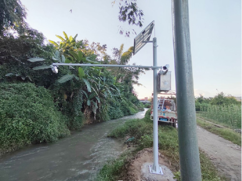
1. monitoring center: including servers, public network line (or mobile line), hydrological monitoring system software.
2. communication network: the use of wireless communication mode of real-time transmission of monitoring data.
3. Front-end monitoring equipment: such as water level meters, rain gauges, flow meters, water quality monitors, etc.
4. Measuring equipment: used to collect and record hydrological parameters.
1. Data transmission distance: support for remote data transmission, applicable to a wide range of geographical areas.
2. High precision: using high-precision instruments and equipment to provide accurate and reliable data.
3. High degree of automation: many monitoring devices can realize automated operation, reducing manual intervention.
4. Flexible and convenient network: support a variety of communication methods to adapt to different environmental needs.
Hydrological monitoring system is widely used in:
1. rivers, lakes, reservoirs: monitoring water level, flow, water temperature and other parameters.
2. agriculture: farmland moisture monitoring, soil moisture monitoring, irrigation water monitoring, aquaculture water monitoring, etc.
3. Industry: water quality monitoring and total discharge control for factory wastewater treatment.
4. Environment: automatic monitoring of ecological environment and agricultural environment.
5. urban planning: urban drainage system, flood control and drainage, etc.
1. provide a basis for water resources regulation: timely access to hydrological data, water resources management and development to provide a scientific basis. 2. protect the water environment: timely access to water resources management and development.
2. protect the water environment: timely grasp of the water body and its environment, take appropriate measures to protect water quality standards, reduce water pollution.
3. improve the efficiency of water resources development and utilization: provide support for water resources development and utilization according to rainfall and lake changes.
4. Predicting water level and disaster prevention and mitigation: predicting changes in flood surface, preventing floods and providing decision support for disaster prevention and mitigation.
- Measure and record the water level changes of rivers, lakes, reservoirs and other waters in real time or on a regular basis to provide a basis for decision-making on reservoir scheduling, flood prevention and early warning, as well as river ecological restoration.
- Through the tipping bucket rain gauge and other equipment, rainfall is accurately measured to provide support for flood control and drainage, water resource management and emergency response.
- Using radar flow meter, ADCP speed measurement and other equipment, real-time monitoring of the flow velocity and flow rate of the water body, to understand the flow of the waters and the distribution of water resources.
- Regularly collect water samples for water quality analysis, measure indicators such as dissolved oxygen, turbidity, pH and chemical composition, assess the health of water bodies, monitor water pollution, and provide scientific basis for water supply and water environment protection.
- Observations include meteorological elements such as precipitation, evaporation, temperature, humidity, barometric pressure and wind, which are essential for weather prediction and climate change research.
- The data collected provides basic information for scientific research in many fields such as hydrology, climatology and ecology.
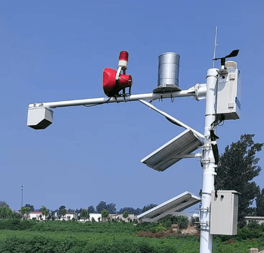
1. real-time and continuity: through automated equipment and remote transmission technology, data can be monitored and transmitted in real time, so that decision-makers can understand the hydrological changes in a timely manner. 2. accuracy and comprehensiveness.
2. accuracy and comprehensiveness: using high-precision instrumentation to provide accurate and reliable data. At the same time, it can monitor multiple hydrological elements and comprehensively analyze hydrological change trends.
3. Wide range of applications: not only for the monitoring of natural water bodies, but also can be applied to the monitoring of artificial water bodies such as urban drainage systems and water treatment plants.
1. High construction and operation and maintenance costs: it is necessary to purchase and deploy a large number of monitoring equipment and establish corresponding data transmission and storage facilities, which costs a lot of money and manpower.
2. Data standardization and sharing difficulties: different regions and departments use inconsistent monitoring equipment and data formats, leading to difficulties in data integration and analysis.
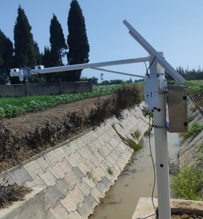
- Collect hydrological data through various sensors (e.g. rain gauge, water level meter, flow meter, etc.).
- The monitoring equipment usually has a built-in storage function for temporarily storing the collected data.
- Wired transmission: data are transmitted to the data processing center through a wired network (e.g. Ethernet).
- Wireless transmission: data transmission using wireless technologies such as radio waves, satellite communications, mobile networks (e.g. 4G/5G, NB-IoT, GPRS, CDMA, Beidou satellite communications).
- The data processing center receives data from each monitoring station.
- Real-time analysis: Use specialized software to process and analyze the data in real time, generating charts, reports, etc.
- Post-analysis: Conduct more in-depth analysis of the stored data for long-term trend research, model calibration, etc.
- Internal sharing: Share data within relevant departments or organizations.
- External release: Releasing monitoring data and warning information to the public through websites, mobile applications and other platforms.
Through these steps, the hydrological monitoring system can realize the rapid collection, transmission, analysis and application of hydrological data, providing support for water resources management, disaster warning and scientific research.
Summarize:
Hydrological monitoring is a scientific activity of continuous observation and measurement of the dynamic changes of natural water bodies through a series of technical means and equipment. Its main purpose is to understand the hydrological cycle, manage water resources, warn of disasters, protect the environment and support engineering design. The monitoring content includes water level, flow, flow rate, water quality, rainfall, evaporation and so on. Monitoring methods include qualitative monitoring (e.g. video filming) and quantitative monitoring (e.g. flow meter method, radar wave flow measurement method). The monitoring system consists of front-end equipment (e.g., water level meter, rain gauge, flow meter), data transmission system (e.g., 4G/5G, satellite communication) and back-end data processing platform to realize real-time data collection, transmission and analysis.
The main functions of the hydrological monitoring station include real-time data collection, disaster early warning, water resource management, water quality protection and environmental research. The advantages are high real-time, high accuracy and wide application, but the construction and operation and maintenance costs are high, and there are challenges in data standardization and sharing. Through these systems, strong support can be provided for water resources management, disaster prevention and scientific research.
Related recommendations
Sensors & Weather Stations Catalog
Agriculture Sensors and Weather Stations Catalog-NiuBoL.pdf
Weather Stations Catalog-NiuBoL.pdf
Related products
 Combined air temperature and relative humidity sensor
 Soil Moisture Temperature sensor for irrigation
 Soil pH sensor RS485 soil Testing instrument soil ph meter for agriculture
 Wind Speed sensor Output Modbus/RS485/Analog/0-5V/4-20mA
 Tipping bucket rain gauge for weather monitoring auto rainfall sensor RS485/Outdoor/stainless steel
 Pyranometer Solar Radiation Sensor 4-20mA/RS485
Screenshot, WhatsApp to identify the QR code
WhatsApp number:+8615367865107
(Click on WhatsApp to copy and add friends)