

— Blogs —
—Products—
 Consumer hotline +8618073152920
 WhatsApp:+8615367865107
Address:Room 102, District D, Houhu Industrial Park, Yuelu District, Changsha City, Hunan Province, China
Product knowledge
Time:2024-11-14 11:01:47 Popularity:1483
1. Real-time mastery of hydrological information: through real-time observation and recording of water level, flow, flow rate, water quality and other hydrological elements of rivers, lakes, reservoirs and other waters, to provide timely and accurate hydrological information for decision makers.
2. Guaranteeing the safety of water resources: through monitoring the changes in water quality, timely detection of water pollution problems, providing a basis for water resources protection and management, ensuring the safety and sustainable use of water resources.
3. Preventing natural disasters: hydrological monitoring can warn floods, droughts and other natural disasters in advance, provide scientific basis for disaster prevention and mitigation, and reduce disaster losses.
4. Support scientific research: hydrological monitoring data for hydrology, meteorology, ecology and other scientific research provides the basic information to help promote the development and progress of related disciplines.
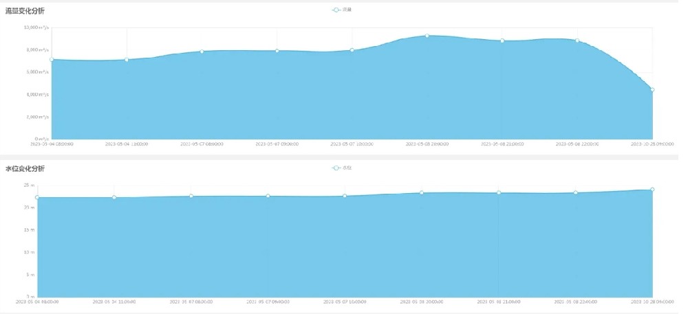
1. Water resources management: hydrological monitoring data is an important basis for water resources management. Through monitoring and analysis of hydrological data, we can formulate a reasonable water resources allocation plan, optimize the structure of water resources utilization, and improve the efficiency of water resources utilization.
2. Flood control and drought relief: In flood control and drought relief work, hydrological monitoring plays a vital role. Through real-time monitoring of water level, flow and other hydrological elements, we can accurately determine the development trend of floods and droughts, and provide scientific basis for flood control and drought relief decision-making.
3. Environmental protection: hydrological monitoring can help timely detection of water pollution problems and provide strong data support for environmental protection departments. By monitoring water quality changes, we can assess the health of water bodies, develop targeted protection measures to improve the quality of the water environment.
4. Disaster prevention and mitigation: hydrological monitoring plays an important role in disaster prevention and mitigation. Through the early warning system, the seeds of natural disasters such as floods and landslides can be detected in advance, and precautionary measures can be taken in time to reduce disaster losses.
5. Supporting urban construction: hydrological monitoring data also have important reference value in urban planning, construction and management. By monitoring the hydrological information of urban drainage systems, lakes, reservoirs and other waters, it can provide a scientific basis for urban drainage planning, flood control and drainage.
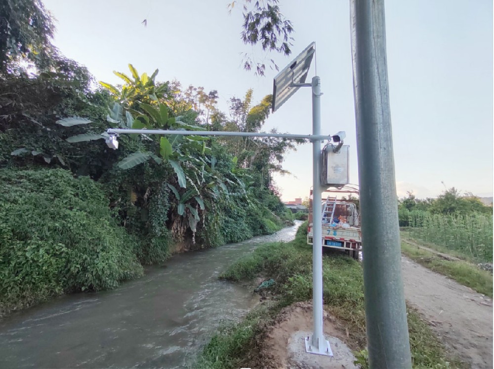
1. resident measurement
- Definition: Hydrological observers are stationed at fixed observation stations in rivers or watersheds to observe hydrological elements such as flow, water level and precipitation.
- Classification: According to the actual needs, stationary measurement can be divided into perennial stationary measurement, flood season stationary measurement or a specified period of stationary measurement.
- Characteristics: stationary measurement is the most basic way to collect hydrological information, but there are many people, not enough stations, low efficiency and other shortcomings.
2. patrol measurement
- Definition: Hydrological observers to tour the flow of water and other hydrological elements in an area or basin of the observation station on a regular or irregular basis.
- Classification: patrol can be regional patrol, along the route patrol, year-round patrol or seasonal patrol.
- Characteristics: Patrol measurement is an important means to solve the problem of unattended stations, with high flexibility, wide coverage and other advantages.
3. Inter-testing
- Definition: small and medium-sized river hydrological stations have more than 10 years of data analysis to prove that the water level and flow of the relationship between the years is stable, or its changes in the allowable error, one of the elements (eg, flow) to stop the measurement of a period of time and then test the test stops between the test mode. Stopping the measurement period, the value of another element (water level) by the measured value to be derived.
- Characteristics: Intermeasurement can reduce the frequency of observation, saving manpower and material resources, but requires a stable relationship between the hydrological elements.
4. Hydrological survey
- Definition: In order to make up for the inadequacy of the basic hydrological station network location observation or other specific purposes, the use of surveys, investigations, testimonials and other means to collect hydrological and related information.
- Characteristics: hydrological survey by the time and place of the less restrictive, can be in the aftermath of the supplementary test, and can be effectively collected to understand the basic station catchment area of the required hydrological information, there is a greater flexibility.
- Application: Hydrological observatories are equipped with a variety of high-precision sensors for measuring hydrological parameters such as water level, flow velocity, flow rate, water temperature, turbidity and pH.
- Advantages: the sensors have high precision, real-time monitoring and other characteristics, which can improve the accuracy and timeliness of data collection.
- Application: Use automated equipment, such as automatic water quality analyzers and automatic samplers, which can work around the clock to automatically collect and record data.
- Advantages: Automated equipment can reduce the error and labor intensity of manual operation and improve the efficiency and accuracy of data collection.
- Application: Satellite remote sensing technology and unmanned aerial vehicles are utilized to monitor a wide range of waters.
- Advantages: Remote sensing technology can provide macroscopic data on water surface area, changes in water bodies and water resource utilization, and is especially suitable for areas that are difficult to reach or have a wide coverage.
- Application: Efficient communication systems that enable real-time data transmission, such as wireless transmission, GPRS, 4G/5G networks, etc., to ensure that data can be transmitted to the monitoring center in a fast and stable manner.
- Advantages: Data communication system can guarantee the real-time and integrity of data and provide strong support for the subsequent processing and analysis of hydrological data.
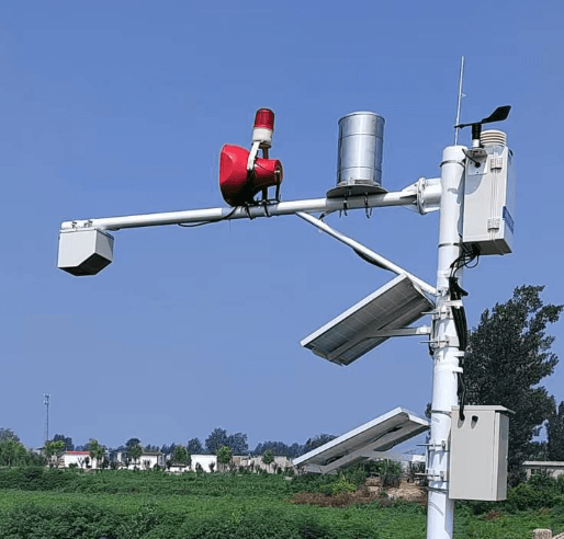
- Content: Clean the collected data to remove noise and abnormal values; preprocessing includes data format conversion, filling in missing values, etc. Purpose: Ensure the accuracy and completeness of the data.
- Purpose: to ensure the accuracy and consistency of the data, to provide a reliable basis for subsequent data analysis.
- Application: Apply edge computing technology to perform data processing near the collection device.
- Advantages: Reduces data transmission time and delay, improves real-time data processing and system response speed.
- Content: Apply statistical analysis methods to calculate basic statistics of hydrological data, such as mean, variance, and trend analysis.
- Purpose: Identify long-term trends and seasonal fluctuations, understand hydrological characteristics and predict future changes.
- Content: Combine the data of multiple hydrological parameters for comprehensive analysis, such as the relationship between water level, flow rate and precipitation. Purpose: To reveal the relationship between different factors.
- Purpose: To reveal the interactions between different factors and provide more comprehensive hydrological information.
- Application: Establishment and use of hydrological models (e.g., streamflow models, flood models) to predict hydrological data. Advantages: Based on physical equations and historical data.
- Advantages: Simulate flows, floods and water resource changes based on physical equations and historical data to provide predictions of future conditions.
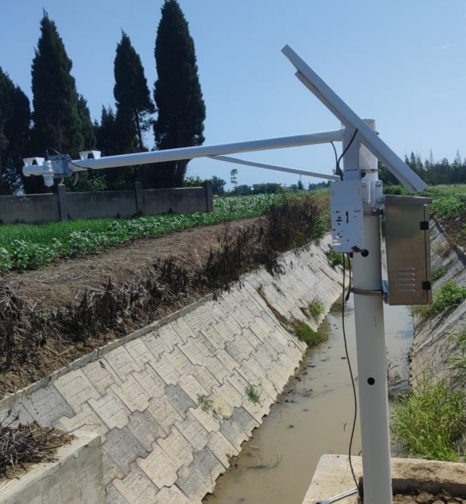
- According to the purpose of monitoring, select representative locations as monitoring stations, such as key sections of rivers, central areas of lakes, and inlets and outlets of reservoirs.
- Rain gauge: used to collect rainfall data.
- Water level meter: including buoy type, pressure type, radar type, etc., used to monitor water level changes.
- Flow meters: e.g. mechanical, electromagnetic, acoustic Doppler flow meter, used to measure the speed of water flow.
- Water quality monitors: used to detect pollutants and chemical composition in water.
- Weather station equipment: including thermometers, hygrometers, anemometers, etc., used to collect meteorological data.
- Direct observation:
- Manual Observation: Periodically, staff will visit the site to observe and record.
- Automatic monitoring: Automatic data collection using sensors.
- Remote sensing technology: Use satellite remote sensing, aerial photography and other technologies to obtain hydrological information from a distance, such as rainfall, soil moisture, and the area of water bodies.
- Model simulation: Predicting hydrological processes through hydrological model simulation to supplement the insufficiency of field observation data.
- Electronic data logger: Automatically record data collected by sensors.
- Paper logging: as a back-up means in case of failure of automatic logging equipment.
- Wired transmission: Transmission of data to the data processing center via cable or fiber optic.
- Wireless transmission:
- Radio wave: short distance transmission, applicable to the monitoring station and data processing center is close to the case.
- Satellite communication: long distance transmission, suitable for monitoring stations in remote areas.
- Mobile network: using GPRS, 3G, 4G and other mobile network technologies to transmit data.
- Preliminary processing: including data cleaning, outlier processing, data calibration, etc.
- Data analysis: Statistical analysis, trend analysis, modeling operation, etc. of data to extract useful information.
- Database management: Store the processed data in a database for easy retrieval and analysis.
- Data backup: Regularly back up the data to prevent data loss.
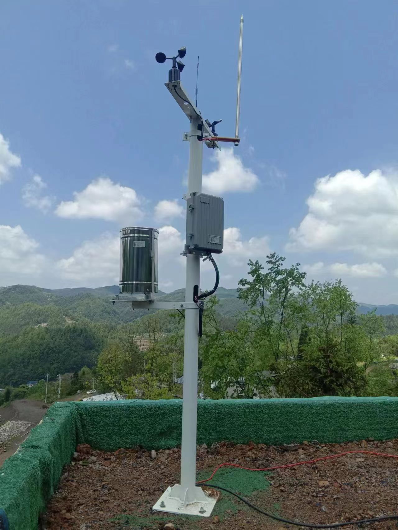
- Sensor manufacturing quality, measurement range and resolution directly affect data accuracy.
- Sensors not regularly calibrated or improperly calibrated will lead to measurement errors.
- Lack of regular maintenance can lead to deterioration in equipment performance and affect data quality.
- Damaged or worn equipment that is not repaired in a timely manner can also lead to inaccurate data.
- Climatic conditions (e.g., temperature, humidity, wind speed) may affect sensor performance.
- Sediment in the water body, plant growth, freezing, etc. may interfere with water level and flow measurements.
- Too low a frequency of data acquisition may result in missing important hydrologic events.
- Too high a frequency may produce large amounts of data that require more processing and analysis.
- Loss of signal or interference during data transmission may result in missing or incomplete data.
- Failure of data storage equipment or improper data management may result in corrupted or lost data.
- Personnel errors during data collection, recording or processing.
- Incorrect data interpretation or analysis methods.
- The geographic location and topography of a monitoring site may affect the representativeness of the data.
- For example, a monitoring station in a valley may not accurately reflect the hydrology of the entire watershed.
- Climate change may lead to changes in hydrological parameters such as rainfall patterns and evapotranspiration rates, affecting the long-term consistency of the data.
- Extreme hydrological events such as floods, droughts, etc. may exceed the measurement range of the sensors, resulting in distorted data.
- Some hydrological parameters (e.g., groundwater flow) are difficult to measure directly and rely on indirect methods of estimation, which may have large errors.
- The selection of data processing and analysis methods may affect the accuracy of the final results.
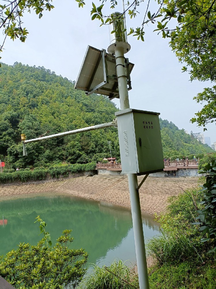
- Regular calibration and maintenance of monitoring equipment: Ensure the accuracy and performance of sensors and equipment.
- Use high-quality sensors: Select sensors with stable performance to reduce measurement errors.
- Optimize the frequency of data collection: set the data collection frequency reasonably according to the monitoring needs.
- Improve data transmission and storage systems: Ensure the reliability of data transmission and the integrity of storage.
- Reduce human intervention: Train staff to reduce operational errors.
- Use standardized data processing and analysis methods: ensure the standardization and consistency of data processing.
In summary, the collection of hydrological data requires the comprehensive use of a variety of ways and technical means, and selection and optimization according to the actual needs and technical conditions. At the same time, data processing and analysis is also an indispensable part of collecting hydrological data, which can provide strong support for water resources management and disaster prevention and mitigation.
Related recommendations
Sensors & Weather Stations Catalog
Agriculture Sensors and Weather Stations Catalog-NiuBoL.pdf
Weather Stations Catalog-NiuBoL.pdf
Related products
 Combined air temperature and relative humidity sensor
 Soil Moisture Temperature sensor for irrigation
 Soil pH sensor RS485 soil Testing instrument soil ph meter for agriculture
 Wind Speed sensor Output Modbus/RS485/Analog/0-5V/4-20mA
 Tipping bucket rain gauge for weather monitoring auto rainfall sensor RS485/Outdoor/stainless steel
 Pyranometer Solar Radiation Sensor 4-20mA/RS485
Screenshot, WhatsApp to identify the QR code
WhatsApp number:+8615367865107
(Click on WhatsApp to copy and add friends)