

— Blogs —
—Products—
 Consumer hotline +8618073152920
 WhatsApp:+8615367865107
Address:Room 102, District D, Houhu Industrial Park, Yuelu District, Changsha City, Hunan Province, China
Product knowledge
Time:2024-12-17 14:54:32 Popularity:2868
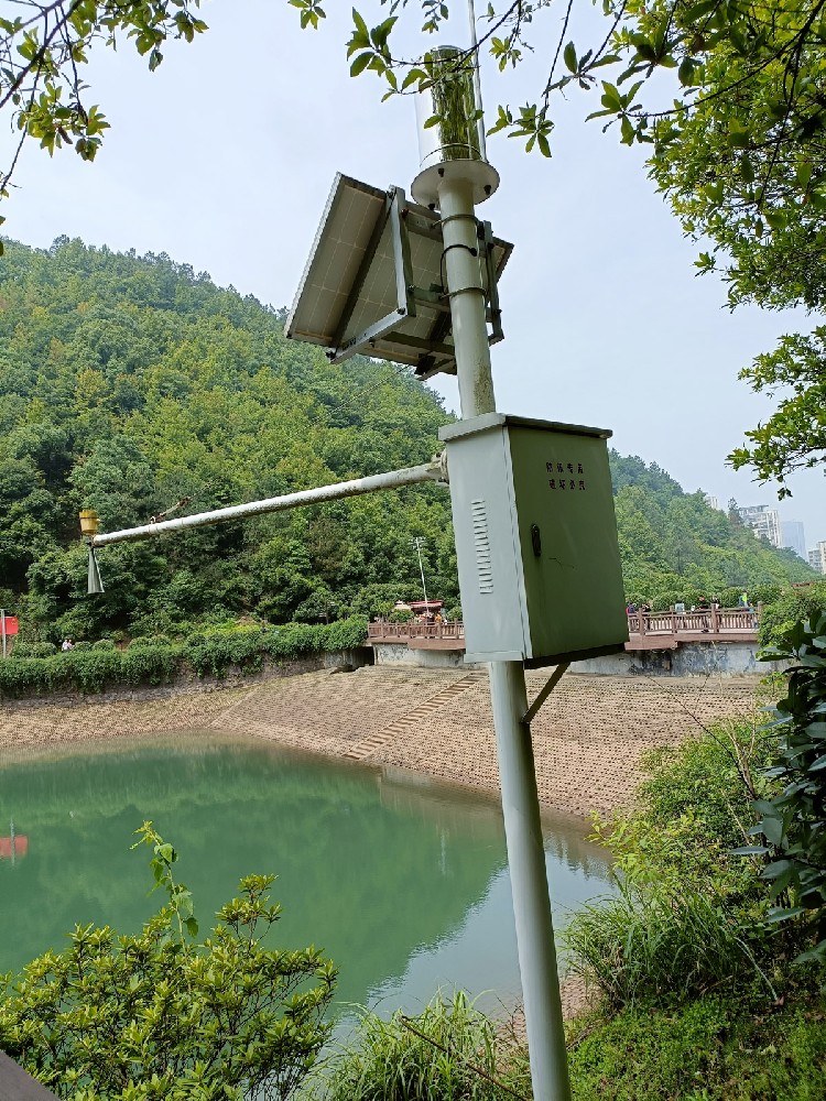
The tools and technologies for monitoring hydrometeorological hazards are diverse and cover a wide range of sensors, remote sensing systems, models and information systems from the ground to space. Together, they form a comprehensive monitoring and early warning system aimed at reducing the impact of natural hazards on human society and the natural environment. The following is a detailed description of these tools and technologies:
Sensors are the basis of hydrometeorological disaster monitoring and are capable of collecting data on various key parameters in real time. Common sensors include:
- Function: Measurement of rainfall.
- Types: tipping bucket type, siphon type, optical type, etc.
- Application: Widely used in weather stations and flood warning systems to provide precipitation data.
- Function: To monitor the water level changes of rivers, lakes and reservoirs.
- Types: float type, pressure type, ultrasonic type, radar type, etc.
- Applications: flood warning, water resource management, assessing water level changes in water bodies.
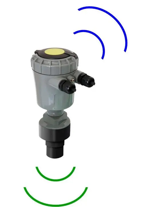
- Function: Measure the flow velocity of water.
- Types: ultrasonic tachometer, electromagnetic tachometer, ADCP (Acoustic Doppler Current Profiler), etc. Applications: flow calculation, flood prediction.
- Applications: flow calculation, flood prediction, monitoring changes in river flow velocity.
- Functions: Monitoring soil moisture content, assessing the degree of soil saturation.
- Types: Time Domain Reflectometer (TDR), Frequency Domain Reflectometer (FDR), etc. Applications: Agricultural irrigation, flood prediction, monitoring of river flow rate changes.
- Applications: Agricultural irrigation, flood warning, assessing soil moisture content.
- Function: Measure the temperature of air and water.
- Types: thermistor, thermocouple, etc.
- Applications: meteorological monitoring, water temperature monitoring, assessment of air and water temperature changes.
- Function: Monitor wind speed and direction.
- Types: mechanical wind speed and direction sensor, ultrasonic wind speed and direction sensor, etc. Applications: weather forecasting, storm warning.
- Applications: weather forecasting, storm warning, assessing the impact of wind.
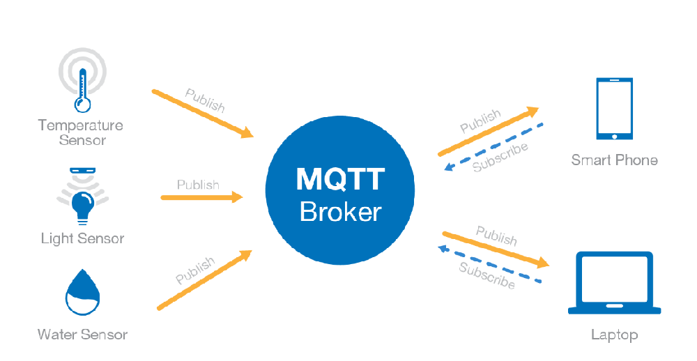
Telemetry systems are used to collect sensor data automatically and transmit the data to a remote monitoring center through wireless communication. The main components include:
- Function: Automatically collects sensor data and performs preliminary processing.
- Characteristics: Supports a variety of sensor interfaces, with data storage and transmission functions.
- Function: Transmits data through radio waves, telephone lines, satellites and other means.
- Types: radio transmitters, receivers, satellite communication terminals, etc.
- Application: Remote data transmission to ensure the timely delivery of real-time monitoring data.
Satellite remote sensing technology utilizes sensors on satellites to observe the earth's surface and provide large-scale surface coverage information. Common applications include:
- Function: To provide worldwide surface coverage information and monitor disasters such as floods and droughts.
- Characteristics: Wide coverage and ability to capture large-scale meteorological phenomena, such as the development of cloud systems that are precursors to typhoons and floods.
- Function: Penetrate clouds and obtain precise information on the ground surface, especially under severe weather conditions.
- Characteristics: Not affected by clouds, suitable for all-weather monitoring.
Weather radar detects the position and speed of target objects by transmitting and receiving electromagnetic waves, and is mainly used to monitor the intensity and distribution of precipitation. Common types include:
- Function: Monitor the distribution, intensity and movement of precipitation, and predict heavy rainfall and flooding.
- Characteristics: High temporal resolution and ability to quickly recognize changes in precipitation patterns.
- Function: Measures the three-dimensional distribution of atmospheric wind speed and direction.
- Characteristics: Provides detailed information on the wind field, which is useful for storm warning.
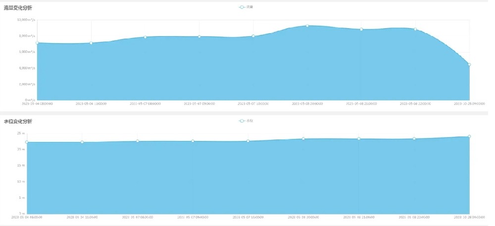
Hydrological models simulate hydrological processes through mathematical and physical methods to predict floods, runoff and other hydrological events. Common types include:
- Function: To simulate how rainfall is converted into runoff processes and predict floods.
- Characteristics: Provide flood warning based on historical data and real-time monitoring data.
- Function: Considers hydrological processes within a watershed for water resource management and disaster warning.
- Characteristics: Provide comprehensive hydrological analysis by taking topography, soil, vegetation and other factors into account.
Information systems are used to store, manage and analyze hydrometeorological data, and release early warning information. Common types include:
- Function: Store and manage hydrometeorological data, provide historical data query and analysis.
- Characteristics: Supports large data storage and efficient retrieval to ensure data integrity and accuracy.
- Function: Integrate spatial data, analyze disaster risk, and support decision support system for disaster management.
- Characteristics: Visualize disaster risks and assist in planning and emergency response.
- Function: Integrates multiple monitoring data, analyzes and predicts potential disasters, and issues timely warnings.
- Characteristics: Includes communication mechanisms to ensure that information is rapidly transmitted to decision makers and the public.
- Function: Used to quickly acquire real-time images and data from disaster sites.
- Characteristics: Highly maneuverable, wide monitoring range, suitable for emergency response and post-disaster assessment.
- Function: Used to monitor the water quality and flow rate of rivers, lakes and oceans.
- Characteristics: Floating on the water surface, real-time data transmission, suitable for long-term monitoring.
- Function: Integrates multiple weather sensors to provide real-time weather data.
- Characteristics: high degree of automation, high data accuracy, suitable for meteorological monitoring in remote areas.
In practical applications, these tools and technologies usually need to be used in conjunction to achieve comprehensive monitoring and early warning of hydrometeorological hazards. For example, in monitoring floods, this can be done through the following steps:
1. data collection: real-time data are collected using rain gauges, water level gauges and stream gauges.
2. Data transmission: Transmission of data to the control center through telemetry systems.
3. Data analysis: Predicting the trend of flooding using hydrological modeling analysis.
4. Early warning release: Early warning information is released through the information system to notify relevant departments and the public to take preventive and mitigation measures.
Summarize
The tools and techniques for monitoring hydrometeorological hazards are diverse, covering a wide range of sensors, remote sensing systems, models and information systems from the ground to space. These tools and technologies not only help us to better understand and manage water resources, but also provide important technical support for environmental protection, public health and sustainable development. Through the integrated application of these tools and technologies, the ability to respond to hydrometeorological disasters can be significantly improved to protect people's lives and property.
Related recommendations
Sensors & Weather Stations Catalog
Agriculture Sensors and Weather Stations Catalog-NiuBoL.pdf
Weather Stations Catalog-NiuBoL.pdf
Related products
 Combined air temperature and relative humidity sensor
 Soil Moisture Temperature sensor for irrigation
 Soil pH sensor RS485 soil Testing instrument soil ph meter for agriculture
 Wind Speed sensor Output Modbus/RS485/Analog/0-5V/4-20mA
 Tipping bucket rain gauge for weather monitoring auto rainfall sensor RS485/Outdoor/stainless steel
 Pyranometer Solar Radiation Sensor 4-20mA/RS485
Screenshot, WhatsApp to identify the QR code
WhatsApp number:+8615367865107
(Click on WhatsApp to copy and add friends)