

— Blogs —
—Products—
 Consumer hotline +8618073152920
 WhatsApp:+8615367865107
Address:Room 102, District D, Houhu Industrial Park, Yuelu District, Changsha City, Hunan Province, China
Product knowledge
Time:2024-11-15 10:25:16 Popularity:381
1. Real-time mastery of hydrological information: through real-time observation and recording of water level, flow, flow rate, water quality and other hydrological elements of rivers, lakes, reservoirs and other waters, to provide timely and accurate hydrological information for decision makers.
2. Guaranteeing the safety of water resources: through monitoring the changes in water quality, timely detection of water pollution problems, providing a basis for water resources protection and management, ensuring the safety and sustainable use of water resources.
3. Preventing natural disasters: hydrological monitoring can warn floods, droughts and other natural disasters in advance, provide scientific basis for disaster prevention and mitigation, and reduce disaster losses.
4. Support scientific research: hydrological monitoring data for hydrology, meteorology, ecology and other scientific research provides the basic information to help promote the development and progress of related disciplines.
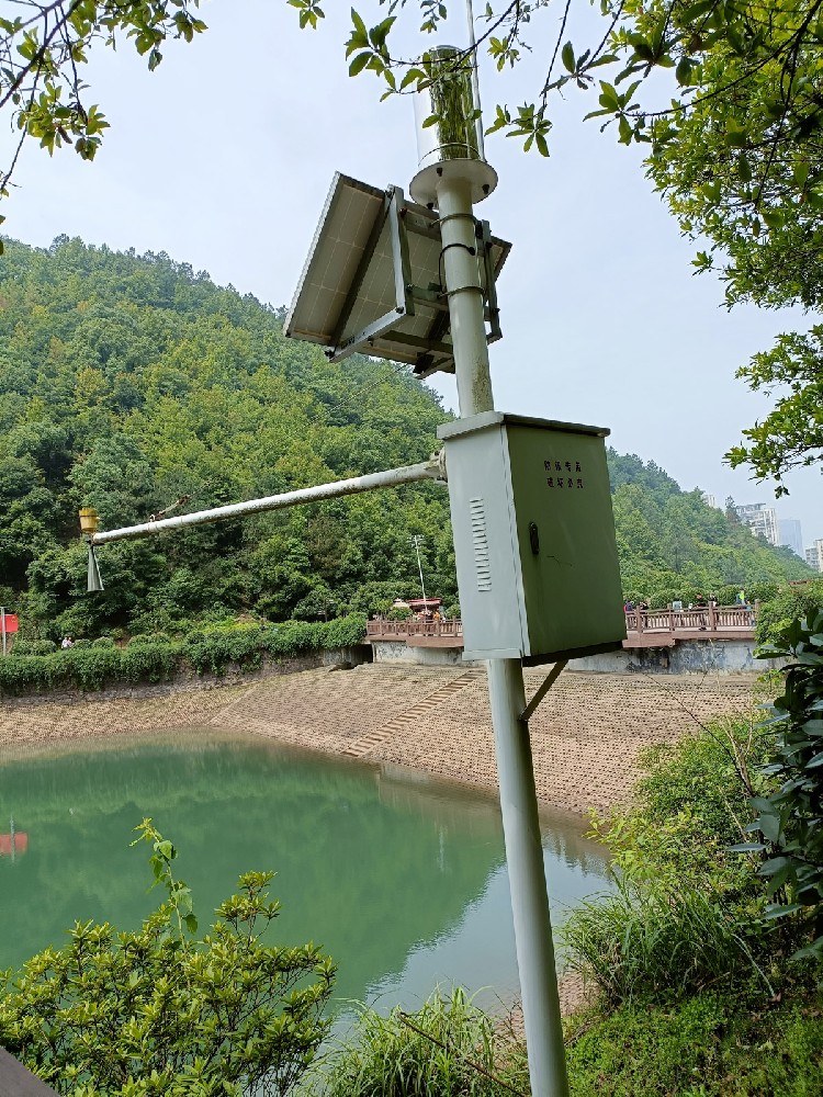
1. Water resources management: hydrological monitoring data is an important basis for water resources management. Through monitoring and analysis of hydrological data, we can formulate a reasonable water resources allocation plan, optimize the structure of water resources utilization, and improve the efficiency of water resources utilization.
2. Flood control and drought relief: In flood control and drought relief work, hydrological monitoring plays a vital role. Through real-time monitoring of water level, flow and other hydrological elements, we can accurately determine the development trend of floods and droughts, and provide scientific basis for flood control and drought relief decision-making.
3. Environmental protection: hydrological monitoring can help timely detection of water pollution problems and provide strong data support for environmental protection departments. By monitoring water quality changes, we can assess the health of water bodies, develop targeted protection measures to improve the quality of the water environment.
4. Disaster prevention and mitigation: hydrological monitoring plays an important role in disaster prevention and mitigation. Through the early warning system, the seeds of natural disasters such as floods and landslides can be detected in advance, and precautionary measures can be taken in time to reduce disaster losses.
5. Supporting urban construction: hydrological monitoring data also have important reference value in urban planning, construction and management. By monitoring the hydrological information of urban drainage systems, lakes, reservoirs and other waters, it can provide a scientific basis for urban drainage planning, flood control and drainage.
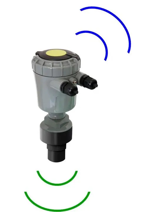
Hydrological monitoring requires a series of specialized equipment and tools to ensure the accuracy and reliability of data. The following are some commonly used hydrological monitoring equipment and tools, as well as their specific functions and application scenarios:
- Purpose: Used to measure changes in the height of the water level of a body of water.
- Type:
- Float-type water level meter: the use of floats with the water level changes up and down, through mechanical or electronic devices to record the water level.
- Ultrasonic water level meter: the use of ultrasonic reflection principle to measure the water level, applicable to a variety of water bodies.
- Pressure hydrometer: by measuring the pressure of the water body to deduce the water level, suitable for deep water environment.
- Bubble water level gauge: by measuring the rising speed of the bubble in the water to deduce the water level.
- Non-contact radar water level meter: using radar wave reflection principle to measure water level, suitable for remote and non-contact measurement.
- Purpose: a high-precision water level measurement tool, applicable to rivers, lakes, reservoirs and other water conservancy projects.
- Characteristics: high precision and strong anti-interference ability, can accurately measure the water level changes, and output switching signals for alarm or control.
- Purpose: Used to measure the speed and volume of water flow.
- Type:
- Electromagnetic flowmeter: the use of electromagnetic induction principle to measure the flow rate and flow, applicable to conductive liquids.
- Ultrasonic flowmeter: the use of ultrasonic propagation time difference or Doppler effect to measure the flow rate and flow, applicable to a variety of fluids.
- Laser distance flowmeter: the use of laser distance principle to measure the flow rate and flow, applicable to high-precision measurement.
- Purpose: Used to measure the flow velocity of a body of water.
- Type:
- Rotor type flowmeter: utilizes the speed of the rotating blade turning with the water flow to measure the flow velocity.
- ADCP (Acoustic Doppler Current Profiler): utilizes the Doppler effect of acoustic waves to measure the flow velocity at multiple depths, suitable for complex water flow environments.
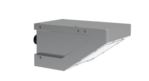
- Purpose: Used to measure precipitation and rainfall intensity.
- Type:
- Tipping bucket rain gauge: using the number of times the tipping bucket is turned over to measure the amount of precipitation, suitable for long-term monitoring in the field.
- Optical Rain Gauge: Measures rainfall by utilizing the principle of light-beam shading, suitable for high-precision measurements.
- Laser raindrop meter: using the laser scattering principle to measure the size and number of raindrops, suitable for detailed rainfall analysis.
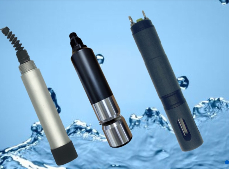
- Purpose: Used to monitor the turbidity, pH, dissolved oxygen, conductivity and other water quality parameters of the water body.
- Type:
- Multi-parameter water quality monitor: integrating a variety of sensors, can measure multiple water quality parameters at the same time.
- pH meter: used to measure the acidity and alkalinity of the water body.
- Dissolved oxygen meter: used to measure the dissolved oxygen content in the water body.
- Conductivity meter: used to measure the conductivity of the water body, reflecting the ion concentration in the water.
- Purpose: Used to measure the moisture and water content of soil.
- Type:
- Conductivity meter: utilizes soil conductivity to measure soil moisture.
- Capacitance Soil Moisture Meter: Measures soil moisture using the capacitor principle.
- Moisture tensiometer: utilizes capillary principle to measure soil moisture tension.
- Purpose: Used to monitor suspended solid particles, sediment content, etc. in water bodies.
- Type:
- Sediment sampler: used to collect sediment samples from water bodies.
- Laser scattering sensor: to measure the concentration and particle size distribution of suspended particles using the laser scattering principle.
- Purpose: Used to collect data from each monitoring device and carry out preliminary processing.
- Characteristics: with data storage, data pre-processing and communication interface functions, supporting a variety of sensor access.
- Purpose: Used for real-time transmission of collected data to the monitoring center.
- Type:
- Satellite communication equipment: suitable for data transmission in remote areas.
- GPRS module: use mobile network to transmit data, applicable to short distance transmission.
- 4G/5G module: utilizes high-speed mobile network to transmit data, applicable to large data volume transmission.
- LoRa module: low-power wide-area network, suitable for low-power and long-distance transmission.
- NB-IoT module: narrowband IoT, suitable for low-power consumption and small data volume transmission.
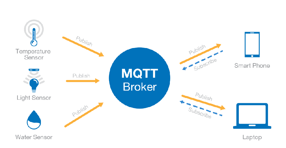
- Purpose: Used for processing, analyzing and storing the transmitted data for subsequent use.
- Type:
- Server: high-performance computing and storage equipment to support large-scale data processing and storage.
- Database management system: used for data storage, management and querying, supporting multiple database formats.
- Data visualization software: for data display and analysis, providing intuitive data view.
- Purpose: When the monitoring data exceeds the preset threshold, it can automatically send out an alarm signal to remind the relevant personnel to take countermeasures.
- Type:
- Sound and light alarm: emits sound and light signals, applicable to on-site alarm.
- SMS Alarm: Notify relevant personnel through SMS, applicable to remote alarm.
- Mail alarm system: notify relevant personnel through e-mail, applicable to remote alarm.
- Platform alarm system: send alarm information through the monitoring platform, supporting multiple alarm methods.
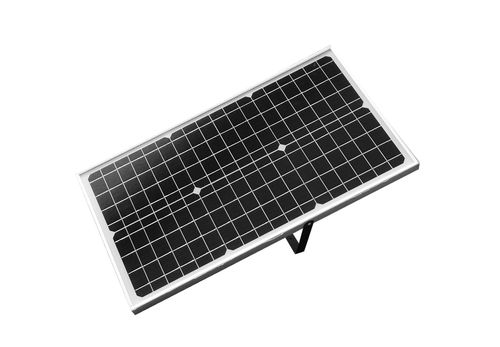
- Equipment Configuration:
- Water level meter (ultrasonic water level meter)
- Flow meter (electromagnetic flow meter)
- Rain gauge (tipping bucket rain gauge)
- Water quality monitor (multi-parameter water quality monitor)
- Data Acquisition Unit
- GPRS module
- Server
- Application Scenario:
- Real-time monitoring of water level, flow, rainfall and water quality parameters of the river.
- Transmit the data to the monitoring center through GPRS module.
- Data processing and analysis in the monitoring center to generate reports and warning information.
- When the water level exceeds the preset threshold, the alarm system is automatically triggered to notify the relevant departments to take measures.
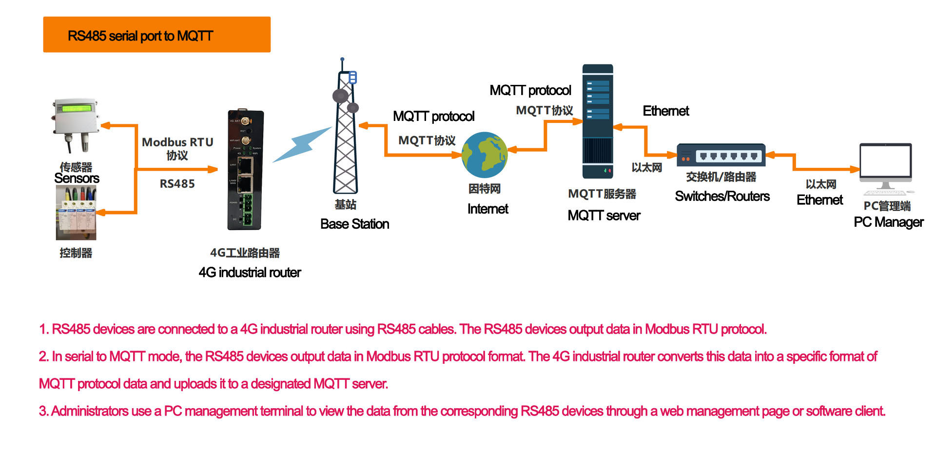
- Equipment configuration:
- Water level meter (pressure type water level meter)
- Flow meter (ultrasonic flow meter)
- Water quality monitor (multi-parameter water quality monitor)
- Data acquisition unit
- Satellite communication equipment
- Database management system
- Application Scenario:
- Real-time monitoring of water level, flow rate, water quality and surrounding soil moisture in the reservoir.
- The data is transmitted to the monitoring center through satellite communication equipment.
- Data processing and analysis are carried out in the monitoring center to generate reports and warning information.
- When the water quality parameters are abnormal, the alarm system is automatically triggered to notify the relevant departments to take measures.
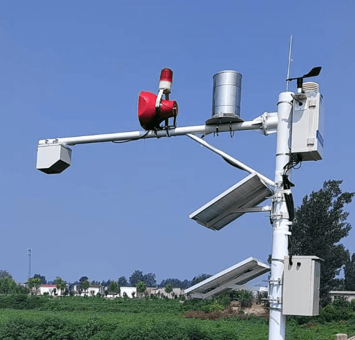
- Equipment configuration:
- Water level meter (non-contact radar water level meter)
- Flow meter (electromagnetic flow meter)
- Rain gauge (optical rain gauge)
- Water quality monitor (pH meter, dissolved oxygen meter)
- Data Acquisition Unit
- 4G module
- Data visualization software
- Application Scenario:
- Real-time monitoring of water level, flow, rainfall and water quality parameters of urban drainage system.
- Transmit the data to the monitoring center through 4G module.
- Transmit the data to the monitoring center through the 4G module, process and analyze the data in the monitoring center, and generate reports and warning information.
- When there is an abnormality in the drainage system, the alarm system is automatically triggered to notify the relevant departments to take measures.
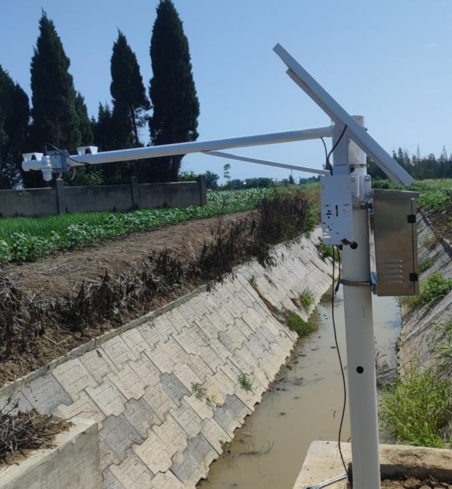
Through the comprehensive use of the above equipment and tools, and reasonable configuration according to specific application scenarios, the accuracy and reliability of hydrological monitoring can be effectively improved, providing strong support for water resources management and disaster prevention and mitigation.
Related recommendations
Sensors & Weather Stations Catalog
Agriculture Sensors and Weather Stations Catalog-NiuBoL.pdf
Weather Stations Catalog-NiuBoL.pdf
Related products
 Combined air temperature and relative humidity sensor
 Soil Moisture Temperature sensor for irrigation
 Soil pH sensor RS485 soil Testing instrument soil ph meter for agriculture
 Wind Speed sensor Output Modbus/RS485/Analog/0-5V/4-20mA
 Tipping bucket rain gauge for weather monitoring auto rainfall sensor RS485/Outdoor/stainless steel
 Pyranometer Solar Radiation Sensor 4-20mA/RS485
Screenshot, WhatsApp to identify the QR code
WhatsApp number:+8615367865107
(Click on WhatsApp to copy and add friends)