

— Blogs —
—Products—
 Consumer hotline +8618073152920
 WhatsApp:+8615367865107
Address:Room 102, District D, Houhu Industrial Park, Yuelu District, Changsha City, Hunan Province, China
Product knowledge
Time:2024-11-24 16:15:42 Popularity:2776
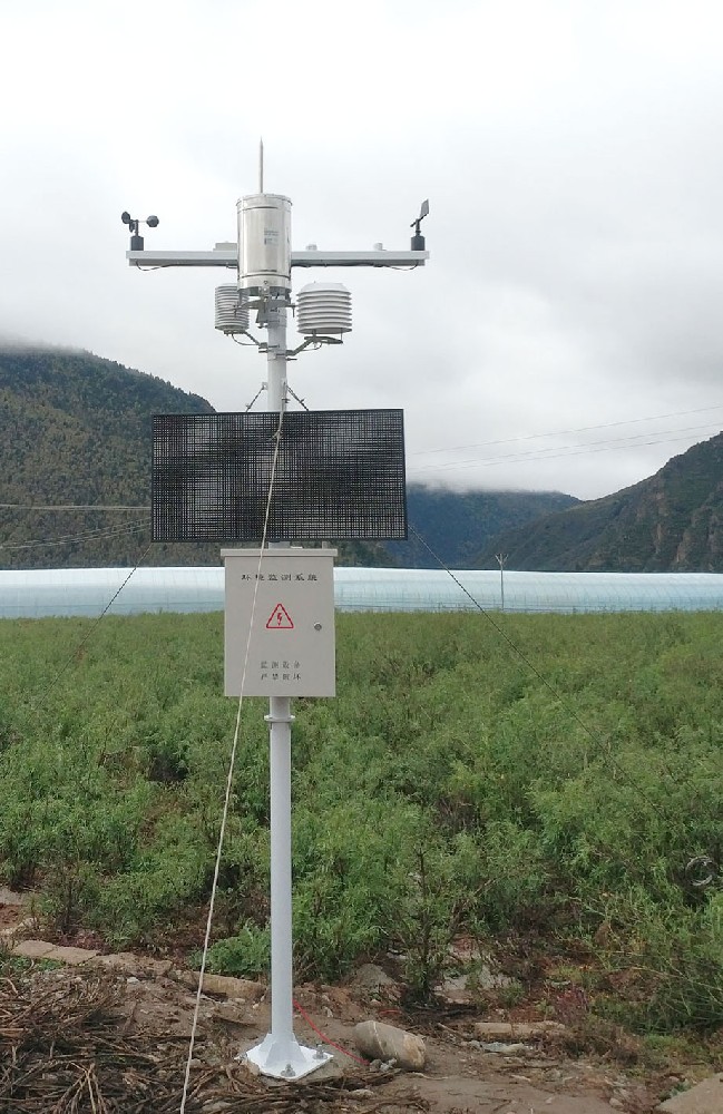
A Professional weather station is an essential tool in modern agriculture, scientific research, and environmental monitoring. Its accurate data collection depends on proper installation and layout. Below is a detailed guide to the installation process and layout principles, designed to help users achieve efficient and precise weather monitoring.
- After unboxing, carefully check if all components are complete, including sensors (air temperature sensor, relative humidity sensor, wind speed sensor, wind direction sensor, rainfall sensor, visibility sensor, soil moisture sensor, etc.), mounts, data collectors, transmission modules, solar panels, and batteries. Ensure that no damage occurred during transport.
- Choosing Installation Location: The site should be open and free from obstructions such as tall buildings or trees that could impact data accuracy.
- Terrain Requirements: The installation should be on level ground, avoiding slopes, low-lying areas, or locations with complex terrain.
- Obstruction Limitations: Ensure that there are no obstacles higher than 1 meter within 10 meters of the observation area, to avoid interference with wind speed, wind direction, or other measurements.
- Distance from Obstacles: Maintain at least 10 times the height of the obstacle from rows of barriers, or 8 times the height from isolated obstacles, with at least 30 meters between two isolated obstacles.
- North high, South low: Higher instruments (e.g., wind speed and direction sensors) should be placed in the north part of the observation area, while lower instruments (e.g., temperature and humidity sensors) should be installed in the southern area. This layout helps reduce interference between instruments and ensures accurate measurements.
- Radiation Measurement Equipment: Instruments like pyranometers or direct radiation sensors should be placed in an open area, such as on a rooftop or on specific surfaces, to ensure they are not obstructed and can accurately measure radiation.
- Reflected Radiation and Net Radiation Sensors: These should be installed in representative areas of the surface that reflect actual radiation conditions.
- Clear Line of Sight: The surrounding area should be free from major obstructions to facilitate observation of cloud cover and visibility. Special locations may be considered if needed to meet observational requirements.
- Instrument Spacing: Instruments should be arranged with adequate space between them. The distance between instruments should be at least 4 meters east-west and 3 meters north-south to avoid interference.
- Edge Distance: Instruments should be placed at least 3 meters from the edge of the observation area or fence to ensure the safety of the instruments and the stability of operations.
- Observation Path: The observation path should allow technicians to approach instruments from the north, with the instruments located on the south side of the path for easy access for maintenance and data reading.
- Mounting Stands: During installation, ensure that each instrument is securely fixed to its stand or base to prevent movement or toppling due to wind or external forces.
- Wind Protection: In coastal or high-wind areas, additional wind protection should be added, such as securing the instruments with wind ropes on tripods.
- Cable Routing: Cables and sensors are critical components and should be routed carefully to avoid mechanical damage or environmental influences. Cables should follow fixed paths and should be regularly checked and maintained.
- Moisture and Water Protection: Ensure that cable connections and sensor interfaces are sealed properly to prevent water ingress.
- Instrument Calibration: After installation, all instruments should be calibrated and tested to ensure accuracy and reliability. Use standard instruments for comparison during calibration.
- Function Testing: Perform functional tests on the weather station, including data collection, transmission, and storage, to ensure all functions are working properly.
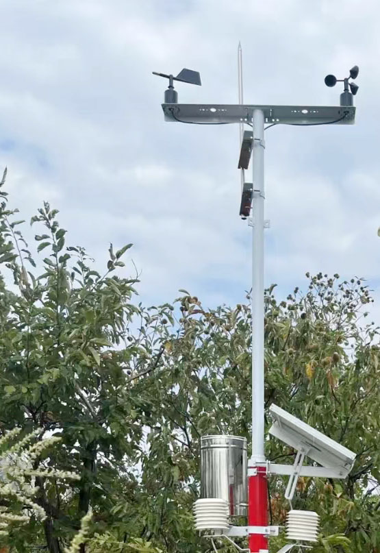
- Physical Isolation: During the design phase, choose materials and layout that ensure adequate physical distance between sensors and potential sources of strong magnetic fields. For example, use non-magnetic materials like aluminum or plastic for sensor mounts and enclosures to minimize magnetic field impact.
- Shielding: Use electromagnetic shielding materials, such as copper or stainless steel enclosures, to protect sensitive components from external magnetic interference.
- Location Selection: During installation, avoid areas with known strong magnetic fields, such as near transformers, high-voltage power lines, or large electric motors. Ideally, the installation should be in a location with minimal electromagnetic interference.
- Sensor Design: Modern sensors often feature interference-resistant designs, such as hardware filtering or software algorithms that reduce the impact of magnetic fields on measurements.
- Directional Installation: For certain sensors, the installation direction can be adjusted to reduce magnetic field impact. For example, wind direction sensors may be designed to minimize the effect of magnetic fields on their directional accuracy.
- Technical Calibration: During data processing, software algorithms can be used to correct for any magnetic field interference, although this does not completely eliminate the interference but can reduce its impact on final data accuracy.
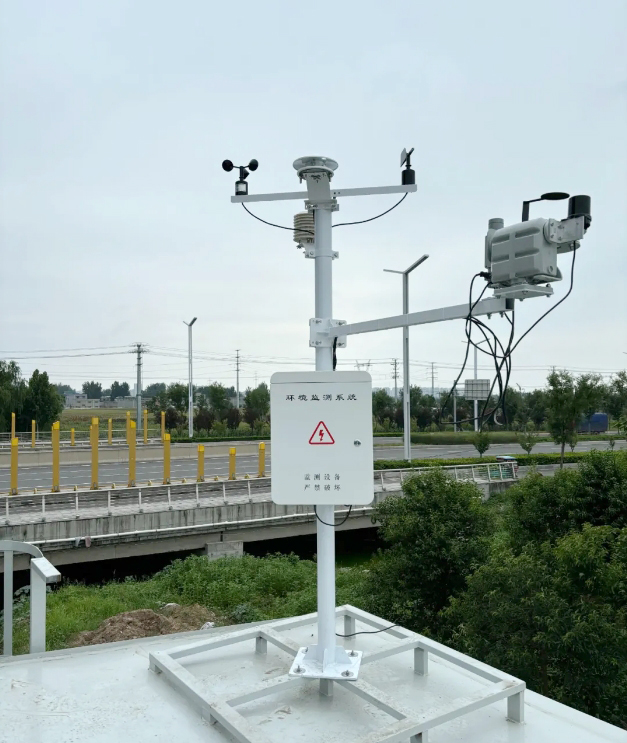
- Installation Check: After installation, inspect all equipment to ensure it is securely mounted, connections are correct, and no damage has occurred.
- Data Collection: Set the data collection frequency and check if the data collector can automatically collect weather data at the set intervals.
- Data Transmission: Test the communication functionality to ensure that data can be transmitted to the designated receiving device or platform. This includes checking both wired (e.g., Ethernet) and wireless (e.g., Wi-Fi, GPRS, 4G, 5G, LoRa) networks for stability.
- Data Storage: Ensure that the collected data is correctly stored in the internal memory or external storage media.
- Calibration Procedures: Calibrate temperature, humidity, air pressure, wind speed, and wind direction sensors according to the manufacturer's instructions. This step is crucial to ensure the accuracy of sensor measurements.
- Data Validation: Compare the collected data with actual environmental conditions to verify the accuracy of the weather station's data collection and transmission.
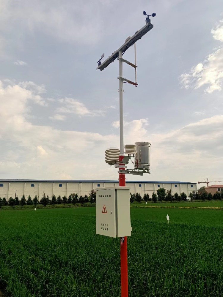
- Perform regular inspections of the weather station, including cleaning sensor surfaces, checking cable connections, and ensuring the system is functioning as expected.
- Address any faults or anomalies immediately and document relevant information for later analysis and improvement.
- In areas prone to thunderstorms, install lightning protection equipment and take additional measures to protect the equipment and personnel.
- Document Organization: Keep records of testing, calibration data, and equipment manuals organized for reference.
- Archiving: Archive all documents for future maintenance and troubleshooting.
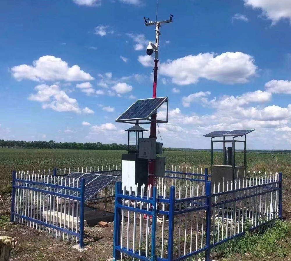
In an agricultural community primarily focused on rice farming, local farmers face various meteorological challenges during the rice growth cycle, such as drought, high temperatures, and flooding. To improve rice yield and quality, the local agricultural promotion center decided to install a Professional Agricultural Weather Station to monitor weather conditions in real-time and provide data support.
After installation, the Professional Weather Station began collecting the following data:
- Temperature: Real-time monitoring of ambient temperature around the rice fields.
- Humidity: Monitoring of ambient humidity levels around the rice fields.
- Wind Speed: Monitoring of wind speed and direction around the rice fields.
- Rainfall: Monitoring of rainfall levels around the rice fields.
- Soil Moisture: Monitoring of soil moisture in the rice fields through soil moisture sensors.

1. Temperature and Humidity Analysis:
- The data indicated that during key growth periods, daytime temperatures were high, while nighttime temperatures were low.
- Combined with humidity data, it was found that high temperatures and humidity during the day could lead to rapid transpiration in rice plants, affecting water absorption.
- Farmers can adjust irrigation times based on this data to ensure rice plants receive sufficient water during the night and early morning.
2. Wind Speed and Direction Analysis:
- Wind speed data showed that the wind speed around the rice fields was generally stable, but increased during specific times of the day.
- Combined with wind direction data, it was found that the wind primarily came from the south, which could increase the evaporation rate in the rice fields.
- Farmers could plan irrigation during times of lower wind speeds to reduce water loss.
3. Rainfall Analysis:
- The data indicated that rainfall was unevenly distributed throughout the rice growth cycle, with some periods of no rain followed by sudden downpours.
- Farmers could adjust irrigation and drainage activities according to the rainfall data to avoid water stress or flooding in the fields.
4. Soil Moisture Analysis:
- Soil moisture data showed significant variations, especially after rain and during sunny days.
- Farmers could adjust irrigation plans based on soil moisture levels, ensuring that the rice plants received adequate water during dry spells.
Conclusion.
By analyzing the meteorological data collected by Profesional weather station, farmers can better understand the meteorological conditions of their paddy fields and adjust their agricultural production strategies accordingly. For example, they can choose the best time to irrigate based on temperature and humidity data, adjust irrigation and drainage schedules based on wind speed and direction data, rationalize farming activities based on rainfall data, and replenish water in a timely manner based on soil moisture data.
This case demonstrates how weather station data analytics can help farmers improve crop yields and quality, reduce agricultural risks, and ultimately improve agricultural economics. In this way, weather station data become an important basis for farmers' planting decisions.
Summary
The installation and layout of a Profesional weather station is a meticulous and complex task that requires strict adherence to a series of scientific rules and standards. Through reasonable layout and careful installation, we can ensure that the weather station can accurately and reliably monitor various weather elements and provide strong data support for agricultural production. Meanwhile, attention should also be paid to the subsequent maintenance and calibration work to ensure the long-term stable operation of the weather station and the accuracy of the monitoring data.
Prev:Agricultural Meteorological Stations: Tools for Modern Agricultural Development
Next:Automatic Weather Station Installation Location Selection Guide
Related recommendations
Sensors & Weather Stations Catalog
Agriculture Sensors and Weather Stations Catalog-NiuBoL.pdf
Weather Stations Catalog-NiuBoL.pdf
Related products
 Combined air temperature and relative humidity sensor
 Soil Moisture Temperature sensor for irrigation
 Soil pH sensor RS485 soil Testing instrument soil ph meter for agriculture
 Wind Speed sensor Output Modbus/RS485/Analog/0-5V/4-20mA
 Tipping bucket rain gauge for weather monitoring auto rainfall sensor RS485/Outdoor/stainless steel
 Pyranometer Solar Radiation Sensor 4-20mA/RS485
Screenshot, WhatsApp to identify the QR code
WhatsApp number:+8615367865107
(Click on WhatsApp to copy and add friends)
