


— Blogs —
—Products—
 Consumer hotline +8618073152920
 WhatsApp:+8615367865107
Address:Room 102, District D, Houhu Industrial Park, Yuelu District, Changsha City, Hunan Province, China
Product knowledge
Time:2025-03-18 10:32:20 Popularity:56
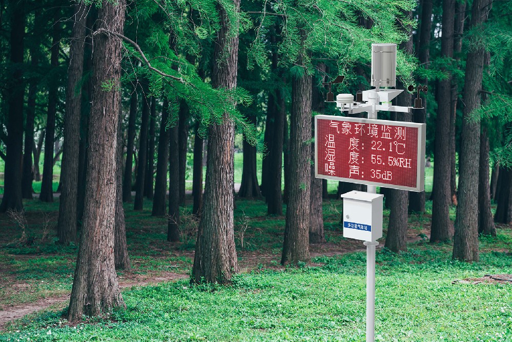
A Forest Fire Hazard Meteorological Monitoring Station is an intelligent meteorological monitoring system designed specifically for forest fire prevention and monitoring. It collects and analyzes key meteorological factors (such as wind speed, wind direction, temperature, humidity, solar radiation, etc.) in real-time, combined with fire hazard level models, to provide scientific data for forest fire risk warnings, fire spread prediction, and firefighting decision-making. It plays a critical role in forest fire prevention, not only reducing the likelihood of fire outbreaks but also providing accurate data support when fires occur, thereby minimizing ecological and economic losses.

A Forest Fire Hazard Meteorological Monitoring Station is an integrated device for data collection, transmission, and analysis, designed to monitor the meteorological conditions within forest areas in real-time. Through the cooperation of multiple sensors and using fire risk assessment models, it analyzes the likelihood of forest fires and the development of fire conditions, providing scientific decision-making support for forest management authorities.
- Fire Hazard Warning: By analyzing meteorological data, it evaluates the dryness and flammability of forest fuels, predicts fire risks in advance, and issues warnings.
- Fire Situation Monitoring: In the event of a fire, it tracks real-time meteorological parameters (such as wind speed and direction), providing support for firefighting efforts.
- Decision Support: It provides quantified data for fire crew deployment, firebreak construction, and resource dispatch, optimizing fire prevention and suppression strategies.
- Data Accumulation: Long-term meteorological data is recorded to provide foundational support for forest fire planning, research, and post-disaster analysis.

The site selection of the Forest Fire Hazard Meteorological Monitoring Station directly impacts its monitoring effectiveness and practical value. It must consider multiple factors such as coverage area, fire hazard level, and monitoring conditions.
| Consideration Dimension | Specific Requirements | Implementation Key Points |
| Coverage Area | Monitoring radius ≥5km per station, higher density in key areas (e.g., forest edges) | Use GIS systems to analyze forest distribution and historical fire hazard data to determine station quantity and layout. |
| Fire Hazard Level | Prioritize deployment in areas with fire hazard level ≥ III (annual fire occurrence rate ≥ 0.3 times/km²) | Refer to national forest fire hazard zoning standards and focus on high-risk areas. |
| Monitoring Conditions | Open visibility ≥270°, no tall obstacles within 100m | Conduct on-site surveys of terrain slopes (suggested ≤15°) and vegetation density to ensure sensor data accuracy. |
| Communication Guarantee | 4G signal strength ≥ -95dBm, backup satellite communication module | Test signal strength on-site with a field strength tester to ensure stable data transmission. |
| Operational and Maintenance Convenience | Distance to nearest road ≤3km, equipped with solar power system (average daily sunlight ≥4h) | Consider impacts of winter snow depth and summer heavy rain, selecting easily maintainable and accessible locations. |
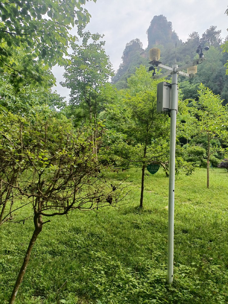
- Ridge Monitoring Station: Utilizes the advantage of height for 360° monitoring, suitable for continuous mountainous areas.
- Forest Edge Observation Point: Located at the junction of farmland and forest to focus on monitoring fire risks caused by agricultural burning.
- Lookout Tower Integration: Built together with existing fire lookout towers, utilizing existing infrastructure to reduce construction costs.
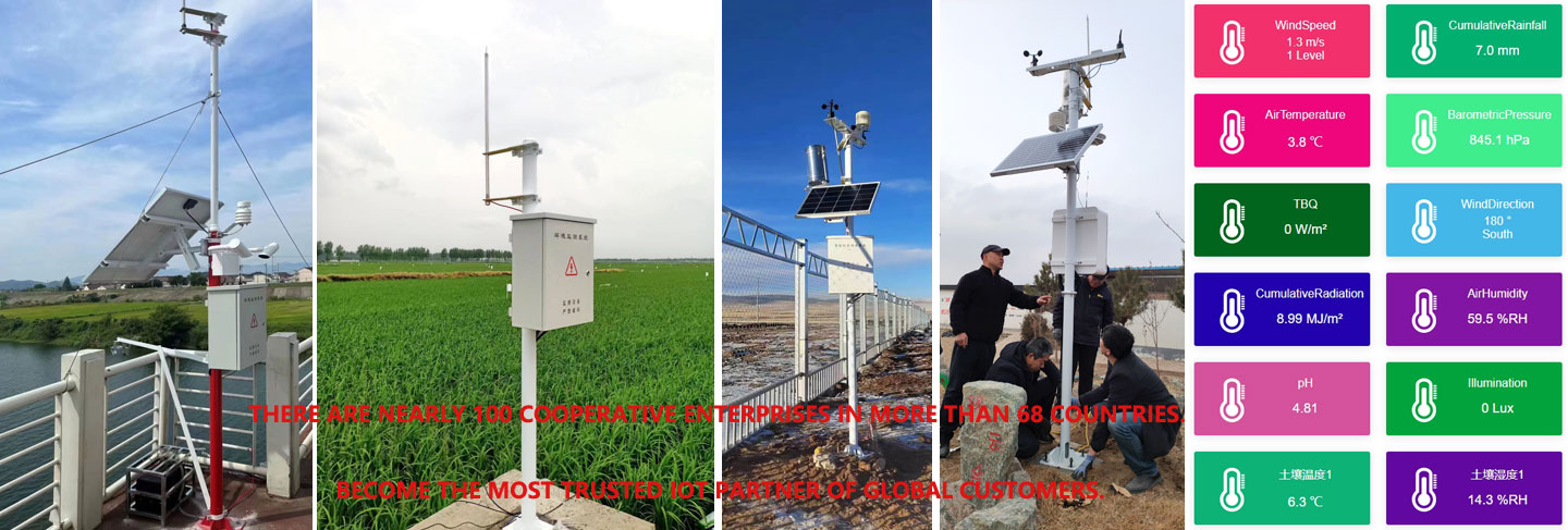
The monitoring capabilities of the Forest Fire Hazard Meteorological Monitoring Station depend on the variety of high-precision sensors it is equipped with. Below is a detailed analysis of the core sensors and their functions:
| Sensor Type | Functional Parameters | Fire Hazard Control Value |
| Wind Speed and Direction Sensor | Range: 0-40m/s (wind speed), 0-360° (wind direction), Accuracy ±0.3m/s, ±3° | Predict fire spread speed (empirical formula: fire speed ≈ wind speed × 0.1), determine fire spread direction. |
| Temperature and Humidity Sensor | Temperature: -40°C to +85°C (accuracy ±0.2°C), Humidity: 0%-100% RH (accuracy ±2% RH) | Calculate the moisture content of combustibles, assess ignition thresholds, lower humidity significantly increases fire risk. |
| Solar Radiation Sensor | Measurement range: 0-2000W/m², Resolution: 1W/m² | Assess ground evaporation and combustible drying process, strong radiation increases fire hazards. |
| Rainfall Sensor | Resolution: 0.2mm, Water inlet diameter: 200mm | Monitor the impact of precipitation on combustible moisture over a time window (usually 24-48h), assist in judging fire hazard reduction. |
| Soil Moisture Sensor | Monitoring depth: 0-50cm, Accuracy ±3% | Assess soil dryness, prevent underground fire spread, provide comprehensive fire hazard information. |
| Infrared Thermal Imager | Detection range ≥2km, Temperature resolution: 0.05°C | Early detection of 0.1m² fire points, enabling rapid fire location. |
| Lightning Detection Sensor | Detection range: 500km, Positioning accuracy ±500m | Early warning of lightning fires (accounting for 30%-40% of forest fires), enhance control of natural fire sources. |
| Atmospheric Pressure Sensor | Range: 300-1100hPa, Accuracy ±0.5hPa | Analyze the correlation between atmospheric pressure changes and dry weather, low pressure is often accompanied by high fire risks. |
- Environmental Adaptability: Military-grade protective design (IP68), operating temperature range -55°C to +70°C, suitable for extreme weather conditions.
- Intelligent Calibration: Built-in temperature and humidity compensation algorithms, automatically correcting sensor drift errors, ensuring data reliability.
- Low Power Consumption: Standby power consumption <0.5W, with a 100Ah lithium battery capable of continuous operation for 7 days, ideal for deployment in remote areas.

- Data Collection Layer: Multiple sensors work together, with a sampling frequency of 1 time/min, ensuring real-time data.
- Transmission Layer: LoRa wireless self-organizing network and 4G dual-link backup, with data transmission latency <3s, ensuring stable communication.
- Platform Layer: Real-time calculation of fire hazard levels based on the FFMC/DMC/DC/ISI/BUI five-factor model, providing visualized warnings.
- Application Layer: Generates fire hazard warning maps, firefighting resource dispatch suggestions, and other tools to visually assist decision-making.
- Accurate Warnings: Multi-parameter coupling analysis, with a fire hazard warning accuracy rate of over 85%, significantly improving prevention effectiveness.
- Quick Response: Fire situation location time <5 minutes, improving efficiency by 20 times compared to traditional manual inspections.
- Cost Efficiency: Single station covers an area 5-8 times larger than traditional lookout towers, reducing operational and maintenance costs by 40%.
- Daily Patrols: Automatically generates daily fire hazard level reports to guide forest rangers in optimizing patrol routes and improving efficiency.
- Emergency Response: In the event of a fire, real-time wind speed and direction data, along with fire spread simulation maps, are pushed to command terminals to optimize firefighting strategies.
- Post-Disaster Evaluation: Reconstructs fire environment parameters using meteorological data to assist in accident investigation and responsibility determination.

VI. Development Trends and Future Prospects
- Multi-source Data Fusion: Integrating satellite remote sensing, drone patrols, and ground sensor data to create an integrated monitoring network spanning sky, land, and space.
- Intelligent Warning Systems: Incorporating deep learning algorithms for sub-meter-level fire point positioning and autonomous judgment.
- Edge Computing Capability: Deploying AI chips at the monitoring station to reduce data transmission dependence and improve real-time alarm efficiency.
- New Energy Applications: Using hydrogen fuel cells and solar energy hybrid power systems to extend continuous operation time to 30 days.
The Forest Fire Hazard Meteorological Monitoring Station is a core pillar of the modern forest fire prevention system. Through scientific site selection, efficient sensor configuration, stable data transmission, and intelligent warning mechanisms, it not only provides early warning before fire outbreaks but also offers precise support during fires, significantly reducing fire damage and protecting forest ecosystems. As technology continues to evolve and the network is deployed, its role in forest fire prevention will be further enhanced, providing a solid guarantee for harmonious coexistence between humans and nature.
Prev:Campus Automatic Weather Station: The Meteorological Steward for Smart Campuses
Next:Agricultural Meteorological Stations: Force of Smart Agriculture Development
Related recommendations
Sensors & Weather Stations Catalog
 Agriculture Sensors and Weather Stations Catalog-NiuBoL.pdf
Weather Stations Catalog-NiuBoL.pdf
Agriculture Sensors Catalog-NiuBoL.pdf
Related products
 Combined air temperature and relative humidity sensor
 Soil Moisture Temperature sensor for irrigation
 Soil pH sensor RS485 soil Testing instrument soil ph meter for agriculture
 Wind Speed sensor Output Modbus/RS485/Analog/0-5V/4-20mA
 Tipping bucket rain gauge for weather monitoring auto rainfall sensor RS485/Outdoor/stainless steel
 Pyranometer Solar Radiation Sensor 4-20mA/RS485

Screenshot, WhatsApp to identify the QR code
WhatsApp number:+8615367865107
(Click on WhatsApp to copy and add friends)
